Roatan Honduras Tours Map: Ports, Beaches and Reef Sites
Roatan is a long, thin island, and the tours spread along it from the ports on the south coast to West Bay at the west end. Here is where you meet, where the boats leave and where the reef sites lie, so you can see where the Roatan island tours take you.
How the island fits together
Roatan is about 59 km long and under 8 km wide. It lies some 65 km off the north coast of Honduras, the largest of the Bay Islands. Coxen Hole, the main town, sits on the south coast. The Port of Roatan and the airport are there.
West End and West Bay face the sea at the west tip. French Harbour and Oak Ridge lie to the east on the south coast. Punta Gorda, on the north coast, was founded by the Garifuna.
Where you meet
Almost every tour meets you at one of two ports. The Port of Roatan is in Coxen Hole. Mahogany Bay, also called Isla Tropicale, is about 5 km east at Dixon Cove. At both, the guide waits outside the port gate with a sign.
The private West End boat is the exception: you can also meet it in West End, in front of the Roatan Chocolate Factory. Most tours collect from hotels too. The step-by-step walk out of each port is on the cruise port page.
| Where you meet | Where it is | Who starts there |
|---|---|---|
| Port of Roatan | Coxen Hole, south coast; usually gate 1 | Most shared and private days |
| Mahogany Bay (Isla Tropicale) | Dixon Cove, about 5 km east; below the security gate | Most shared and private days |
| Roatan Chocolate Factory | West End | The private West End snorkel boat |
| Your hotel or rental | West End, West Bay, the East End | Almost every tour; the night snorkel only |
| The airport | Beside Coxen Hole | The customizable days |
Where the boats leave
The snorkel boats do not leave from the cruise piers. A van takes you to the operator's dock first, and the drive is part of the tour time. French Cay harbour, east of the ports, is the base for the kayaks, the hydrobikes and the night snorkel.
| Where the boats leave | Which trip |
|---|---|
| Big Bight, 30 to 40 minutes' drive | The 3-stop shipwreck and starfish trip |
| French Cay harbour | The kayaks, the hydrobikes, the night snorkel |
| The operator's south-side dock | The 3-stop hopping trip |
| A private dock, 15 to 20 minutes' drive | The reef snorkel |
| West End | The private boat to Blue Channel |
| West Bay Beach | The Blue Rock snorkel, five minutes out |
The beaches
West Bay is the long public beach at the west end, where most shore excursions spend their beach time. West End, just north, has the small bay and the village. Brady's Cay is a small island beach off the south coast, reached on the 3-stop hopping trip.
Pickups past Dixon Cove cost more on the private West End boat, because of the distance: US$15 to US$20 a person, and US$30 past French Harbour.
The reef sites
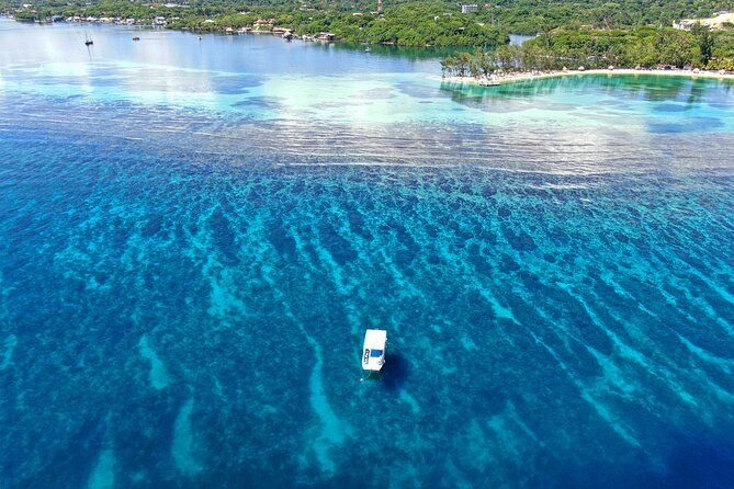
The reef wraps around the island. Off West End, the boats use Blue Channel, the Aquarium and Turtle Crossing, a few minutes apart. Off West Bay, Blue Rock is five minutes out by boat.
On the south coast, the Coco View reef wall and French Cay are the hopping trip's stops. The whole reef lies inside the Bay Islands National Marine Park. Its coastal zone runs from the high tide line to a depth of 10 m.
The airport and the ferries
Juan Manuel Gálvez International Airport is beside Coxen Hole, and several private days collect you there. Ferries link Roatan with Utila, the next island west, and with La Ceiba on the mainland.
None of these tours goes to Utila or La Ceiba. Check a ferry's times with the ferry company before you plan around one.
Map of Roatan
Roatan, Bay Islands, Honduras
The
cruise ports, West End, West Bay and the reef
The map loads from Google only when you press the button. The cruise ports are on the south coast, and West Bay and West End are at the island's western tip.
Questions about the map
How big is Roatan?
How far is West Bay from the cruise ports?
Can I reach Utila or La Ceiba on a cruise stop?
Can I take a tour if I am staying on the island?
Where these facts come from
The island's size, towns, airport and ferries, and the two ports' distance, are from the Wikipedia article on Roatan, checked 21 September 2026. The protected area and its zones are the Roatan Marine Park's page. Every meeting point, dock, drive time and surcharge comes from the operator's own listing.
Next: walk out of your port with the cruise port guide, see things to do, or compare every tour on Roatan Honduras Tours.