Roatan Honduras Facts Most Cruise Visitors Never Learn
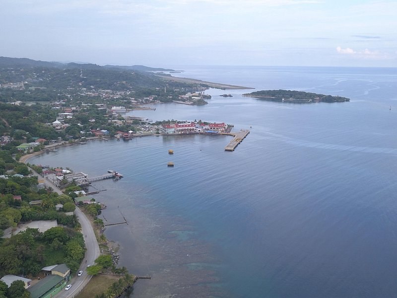
The short answer. Roatan is a coral island on the edge of the second-largest barrier reef in the world, inside a marine park bigger than any other in Honduras. Its first language for two centuries was English, its name was once spelt Rattan, and pirates, a British garrison and the Garifuna all passed through before the cruise ships did. Here is what most visitors walk past.
The island at a glance
| The fact | |
|---|---|
| Length | About 59 km, and under 8 km wide |
| Distance from the mainland | About 65 km off the north coast of Honduras |
| What it stands on | An exposed ancient coral reef |
| The protected sea | 647,153 hectares, declared on 10 June 2010 |
| Cruise ports | Two, about 5 km apart |
| Clock | Central Standard Time, six hours behind UTC |
1. The island is an old reef
Roatan is a coral island. It sits on top of an exposed ancient coral reef, which is why its shore drops so quickly into deep water. You drive over old reef on the way to the new one.
2. It is long and very thin
The island runs about 59 km end to end but is less than 8 km across at its widest. It lies about 65 km off the north coast of Honduras, the largest of the Bay Islands, between Utila and Guanaja. Its airport, Juan Manuel Gálvez International, sits beside Coxen Hole and takes nonstop flights from several US cities, and from Canada in winter.
3. The far east end is almost its own island
The easternmost quarter is cut off by a channel through the mangroves only 15 m wide. That section is called Helene, or Santa Elena in Spanish. Most visitors never get that far: the cruise ports and the beaches are all in the west.
4. The reef is part of the second-largest barrier reef in the world
The reef around Roatan belongs to the Mesoamerican Reef, which the Roatan Marine Park describes as the second-largest barrier reef in the world, shared by Mexico, Belize, Guatemala and Honduras. When you snorkel the Blue Channel, you are on the same system as the reefs of Cozumel and Belize.
5. The whole archipelago is a marine park
On 10 June 2010 the Bay Islands National Marine Park was declared, covering Utila, Roatan, Santos Guardiola and Guanaja. At 647,153 hectares, it is the largest marine protected area in Honduras. It runs from the high-tide line out to a buffer zone 12 nautical miles offshore. Inside it, a coastal zone reaches 10 m deep and a special marine zone, where the corals, fish and sponges live, reaches 60 m. The outer buffer is where sharks, marine mammals and open-ocean fish are found.
6. Deep water starts just offshore
The island rises from a steep slope that falls into the Cayman Trench. That slope drives an upwelling of nutrient-rich ocean water, which feeds the dense fringing reef and the wall dives along the north side. It is the same edge you see at the Blue Channel, where the reef gives way to open blue.
7. The reef fee is voluntary
Much of the day-to-day protection comes from the Roatan Marine Park, a non-profit formed in January 2005 by dive operators and local businesses. It asks visitors for a voluntary US$10 fee to protect the reef and gives you a bracelet or token in return. Nobody will stop you at the water's edge without one, but the money pays for the patrols. How it works is in the visitor guide.
8. English came before Spanish
Most of the island's long-standing families arrived from the Cayman Islands in the 1830s, after the 1833 Slavery Abolition Act changed life there. Their descendants, the Islanders, speak Bay Island English. Some Spanish-speaking Hondurans call them caracoles, snails, a name many Islanders dislike; say Islanders. That is why your guide may switch between English and Spanish without a pause.
9. It was once spelt Rattan
Old maps and papers call the island Ruatan, Ruattan or Rattan. The Anglo-Honduran treaty of 1859 used Rattan. Britain had declared the Bay Islands a colony in the 1850s, then ceded them back to Honduras within a decade.
10. A pirate's prisoner escaped here
In 1722 the fisherman Philip Ashton, taken by the pirate Edward Low, slipped away while the crew were filling water casks on Roatan. Ashton spent the next year alone on the then empty island, and the account Ashton left is one of the few pictures of Roatan before settlement.
11. A British garrison held the island
During the War of the Austrian Succession, British troops under John Caulfield garrisoned Roatan from 1742 to 1749. The garrison began as two companies of Gooch's American Regiment, later merged into the 49th Regiment of Foot.
12. The Garifuna arrived in 1797
In 1797 the British deported the Garifuna from St Vincent to Roatan. Most moved on to the mainland, but some stayed to found Punta Gorda on the north coast, and they became the Bay Islands' first permanent settlers after Columbus. Ask your guide about it if your route goes east.
13. The two ports are five kilometres apart
The Port of Roatan in Coxen Hole is a two-berth port run by the Royal Caribbean Group. Mahogany Bay, owned by Carnival, is about 5 km to the east in Dixon Cove, and is being renamed Isla Tropicale. The Port of Roatan can also take ships at anchor, with passengers tendered ashore; Mahogany Bay cannot. Which one your ship uses decides your walk to the tour, as the cruise port page explains.
14. Your watch and the island may disagree
The island keeps Central Standard Time, six hours behind UTC, all year. A ship may keep a different clock, which is why the private day from 2K's runs on ship time and says so. Check which clock your pickup uses the night before.
15. The wettest month is not in summer
By our average of NOAA's daily records for the airport station, 1991 to 2020, November brings the most wet days, about 16, and April the fewest, about 3. The Atlantic hurricane season runs from 1 June to 30 November, peaking around 10 September. Month by month detail is on the weather page, and what it means for a tour is on the best time to visit page.
16. The birds are protected too
The island is part of an Important Bird Area named by BirdLife International, for its white-crowned pigeons, chimney swifts and yellow-naped amazons, a green parrot with a yellow patch on the neck.
What to do with all this
- See the reef the island stands on: the three-stop snorkel reaches the Blue Channel drop-off.
- Hear the history: the customizable full day lets you choose stops and ask the questions.
- Taste the island: the cooking class teaches Honduran pastelitos and a coconut stew.
Deborah G. called the cooking class a hands-on lesson in the island's food history. Grisel C.'s custom day added a private mangrove boat ride, with tarpon and turtles. Where every stop sits is on the Roatan map.
Days that show you the island behind the facts
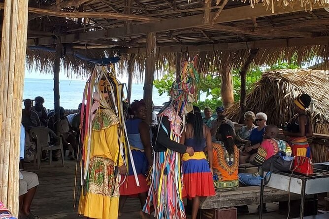
Customizable Best Of Roatan Island Tour in Honduras
A driver and guide for the whole day, stops chosen by you, and pickup whenever you are ready. The entry fees at each stop are paid as you go.
From $45 per person
Check Availability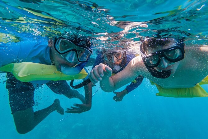
Boat and Snorkeling in West End (Blue Channel, The Aquarium, Turtle Crossing)
A boat and captain for your party alone, off West End: three spots a couple of minutes apart, with fins on request to protect the reef.
From $100 per person
Check Availability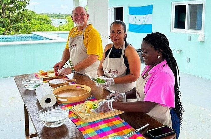
Roatan Cooking Class and Cultural Experience
A hands-on class in a Roatan kitchen: pastelitos, then chicken stewed in coconut milk with plantains, and the recipes to take home.
From $125 per person
Check AvailabilityNext: Put a mask on over that reef with our guide to a first time snorkeling here. Every fare sits side by side on Roatan Honduras Tours.